

San Francisco is a city like no other. Aside from its iconic attractions and activities, SF is one of the most beautiful destinations in California. From expansive city gardens and recreation areas to seashores and state parks, you’ll find many incredibly scenic places to hike in San Francisco and the surrounding areas.
Being a city of such natural beauty, a San Francisco trip is not complete without exploring a trail. So to help you balance out the urban offerings of the city, these are the top hikes in San Francisco.
Best Hikes in San Francisco (within the city limits)
If you’re only in San Francisco for a couple of days, you might not want to venture too far from the city center. That’s no problem, as many of the best walks in San Francisco are within the city limits.
But first: Don’t miss the other California hiking guides, plus park and city guides too!
Batteries to Bluffs Trail
- Length: 2.2-mile (3.5 km)
- Difficulty: Easy
- Elevation gain: 449 feet (137 m)
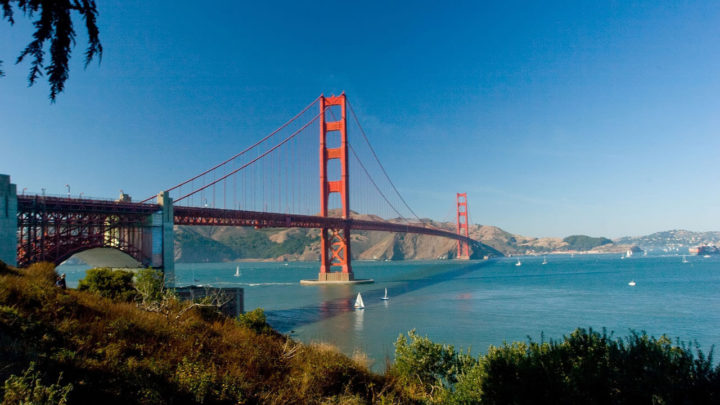
You can’t beat a hike that gives incredible views of the Golden Gate Bridge. The Batteries to Bluffs 2.2-mile (3.5 km) walking route starts at Lincoln Blvd by Golden Gate Bridge and finishes at Baker Beach before looping back around. The course passes through the Presidio and Marshall’s Beach, offering a splendid photo opportunity stop-off.
The trail includes a pedestrian walkway, multiple stairs, and lovely sandy areas, staying close to the shoreline. It’s short, gentle, and accessible to most, yet it offers a magnificent elevated vista of the bay and bluffs. It doesn’t take much longer than an hour to complete. Plus, as it’s within the city center, it makes an excellent addition to your San Francisco trip.
Twin Peaks
- Length: 2.2-mile (3.4 km)
- Difficulty: Easy
- Elevation gain: 272 feet (83 m)
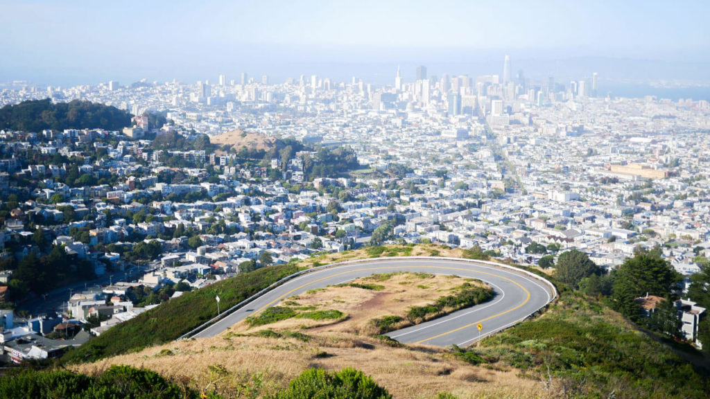
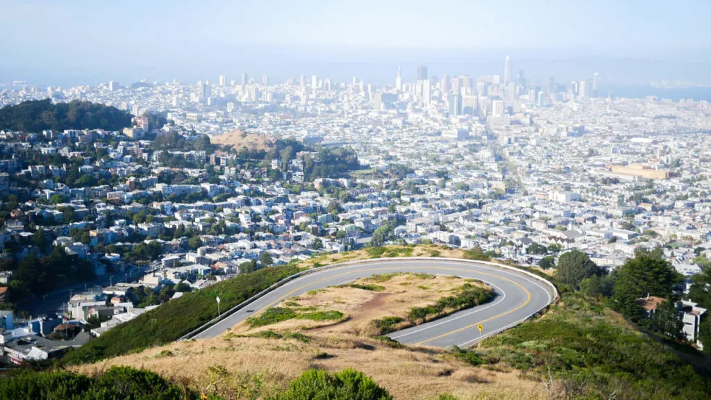
Twin Peaks is undoubtedly one of the best hiking trails in San Francisco and a must for all first-time visitors. One of the top San Francisco activities, this 2.1-mile takes about an hour to finish and starts from Clarendon Avenue, close to the city center.
Although the route is short, there are numerous steps to climb, so it does feel like a bit of a workout. Even so, if you go slow and stop along the way, it’s not too strenuous. What’s more, the view you’ll experience from the top makes it totally worth the effort. The trail loops around both peaks, which you can climb to the top of for even better city vistas.

Lands End
- Length: 3.4-mile (5.47 km)
- Difficulty: Moderate
- Elevation gain: 538 feet (164 m)
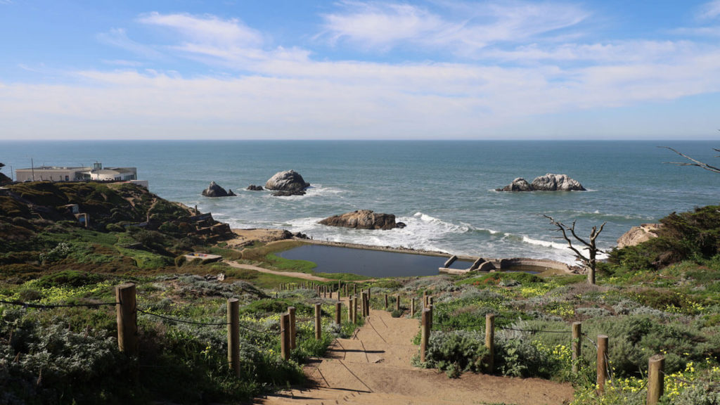
Another one of the most popular San Francisco urban hikes is the Lands End trail. This course loops through the Golden Gate Recreational Area, giving incredible views of the bridge, ocean, and Marin headlands. This trail is steeped in history, too, as the route follows an ancient electric streetcar coastal line that operated from 1905 to 1925.
The most popular place to join the loop is Sutro baths. This 18-century landmark served as a lavish public bathhouse with seven different swimming pools. From Sutro baths, you’ll follow the coastline to Land’s End Eagles Point, passing various notable places, such as Labyrinth, Mile Rock Beach, and the Memorial for Peace.

Lover’s Lane
- Length: 0.6-mile (1 km)
- Difficulty: Easy
- Elevation gain: Minimal
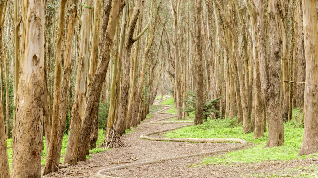
Lover’s Lane is one of the shortest hikes in the Bay Area. It’s also the oldest foot trail here, consisting of a paved route built in the 18th-century. The 0.6-mile walk starts from the beginning of Presidio Blvd, passing by Andy Goldsworthy’s Wood Line, a 1,200-ft winding line of recycled eucalyptus tree trunks.
To make your walk longer, you can combine Lover’s Lane with the Ecology Trail, extending it to 2 miles (3.22 km) and turning it into a small loop around the Presidio. This will add a slight incline and some lovely views across the bay.
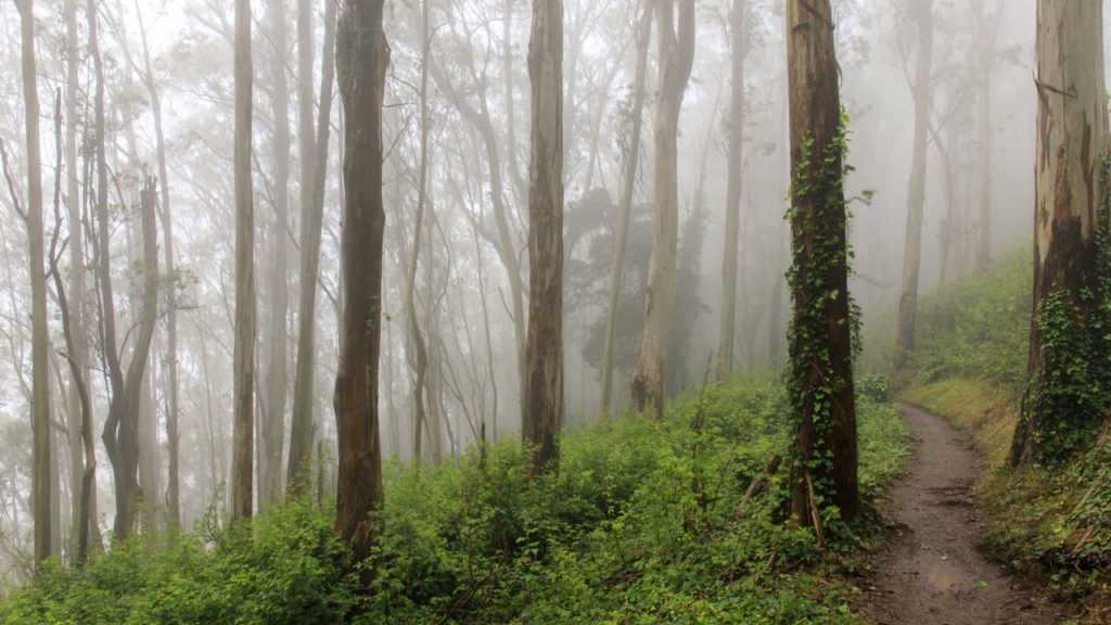
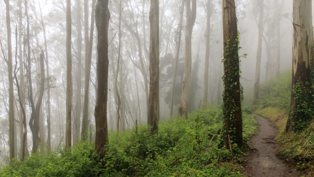
Mount Sutro
- Length: 2-mile (3.2 km)
- Difficulty: Moderate
- Elevation gain: 492 feet (150 m)
Mount Sutro Open Space Reserve is a 61-acre grassy hill area just south of Golden Gate Park with around 5 miles of hiking trails. However, the 2-mile Mount Sutro loop is the most popular, involving a slight incline.
The reserve is much quieter than other parks in the city, so it is an excellent place to come when you want some peace and quiet. You’ll enjoy a tranquil ambiance amongst the magical forest scenery. You can also climb to the top of the hill, and with an elevation gain of 900 feet, it will get your heart racing.
Best Hikes Around San Francisco
If you’ve got more time in San Francisco, you’ll be pleased to know there are many peaceful hiking trails in the city outskirts. The following surrounding areas are perfect for when you want to escape the hustle and bustle for a few hours.

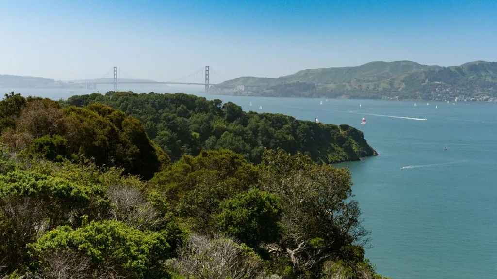
Mount Livermore, Angel Island
- Length: 4.6 miles (7.4 km)
- Difficulty: Easy
- Elevation gain: 492 feet (150 m)
An easy way to escape the city without going far is to take the short ferry ride from Fisherman’s Wharf to Angel Island. Here you will find a blissful state park with the 788-foot Mount Livermore in its center.
The Sunset Trail to Mount Livermore is a primarily gentle 4.6-mile route. It leads through pines, oaks, and various wildflowers before opening out to panoramic views of the bay area. There is a slight incline throughout, so the 2-hour hike never feels too steep or strenuous.
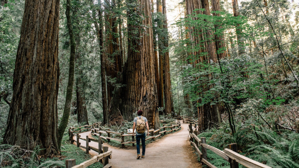

Muir Woods
- Length: 1.3 miles (2.1 km)
- Difficulty: Easy
- Elevation gain: 39 feet (13 m)
A 40-minute drive north of Downtown San Francisco will bring you to the incredibly tranquil redwood forest, Muir Woods. There are various trails to do here, many of which have wooden boardwalks and paved paths, making it a very accessible hiking destination.
The entire 1.3-mile Fern Creek Loop is flat, making it popular with families and locals. The forest walk starts at Alice Eastwood Group Campsite and follows the serene creek before joining the Camp Eastwood Trail to loop back to the starting point.
You can also extend your walk by continuing south along the Main trail. Then cross the river and come back up via the Hillside Trail.
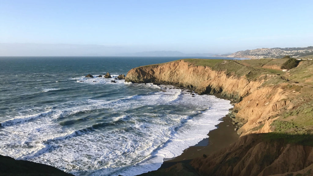

Mori Point
- Length: 2.5 miles (4 km)
- Difficulty: Moderate
- Elevation gain: 393 feet (120 m)
Drive less than half an hour south of San Francisco, and you’ll find the beautiful 32-acre wetland park of Mori Point. Here, you can walk the 2.5-mile Mori Point Loop Trail, enjoy stunning ocean views, and even spot some whales. Some parts of the trail are steep, and there are loose rocks at times, so be sure to wear proper hiking shoes.
If you want to stay longer here, take the ridgeline trail too. You can see as far out as the Golden Gate Bridge on a clear day along this route. Mori Point also puts on a magnificent sunset, so I recommend coming just before dusk.

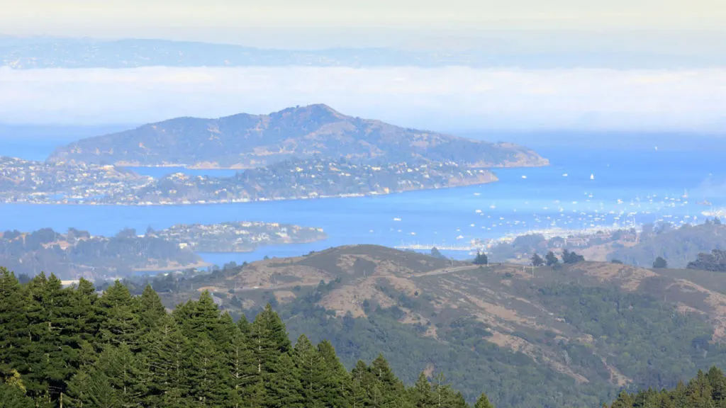
Mount Tamalpais
- Length: 7.5 miles (12 km)
- Difficulty: Moderate
- Elevation gain: 1689 feet (515 m)
Just north of Muir Woods in Mount Tamalpais State Park, it consists of over 100 miles of hiking and biking trails and a 2,571-foot peak. So if you want to spend a day hiking close to San Francisco, Mount Tamalpais is the place to come.
Recommended is the 7.5-mile Dipsea Trail, Steep Ravine Trail, and Matt Davis Loop, which begins by the coast at Stinson Beach and takes you up to Pantoll Ranger Station. It will take around 4 hours to complete and involves a 1000 ft climb. So, make sure you take plenty of water and snacks for this one.
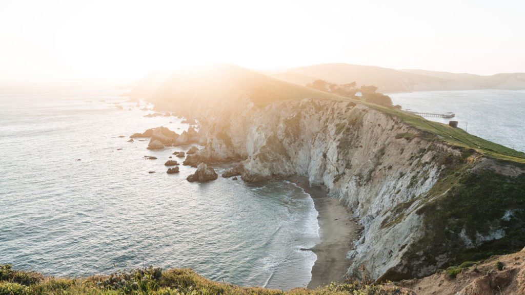
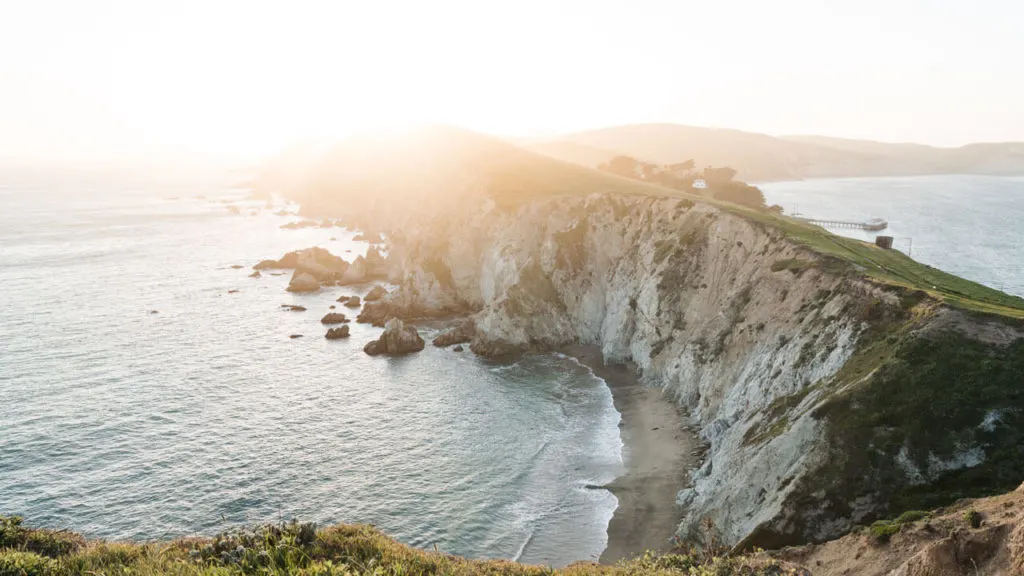
Point Reyes
- Length: 1.9 miles (3 km)
- Difficulty: Easy
- Elevation gain: 269 feet (82 m)
Point Reyes is almost an hour from Downtown San Francisco, but this 71,000-acre park is well worth the drive. This area of rugged coastline has many beaches and lagoons that you’ll see, and it’s a popular spot for whale sightings.
Recommended is the 1.9-mile out and back Chimney Rock Trail that passes the historic lifeboat station and goes right out to the tip of the headlands. It’s quieter than the Point Reyes Lighthouse Trail, but the viewpoint gives incredible ocean vistas. Here you can watch the waves crashing against the rocks and enjoy the tranquil ambiance of this secluded spot.