
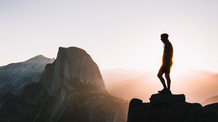

California is full of natural beauty and is home to nine national parks, which makes it one of the best US states for outdoor sports and hiking. However, with so many hiking trails in California, knowing which is best for you is not easy. But you’re covered as I share 10 of the most breathtaking hikes in California, from easy to moderate.
Best Hikes in California
California has a highly diverse landscape, including mountains, desert, redwood forest, and towering cliffs. Here are a variety of hiking trails in California, ranging from 1 to 8 hours, both in national parks in California and beyond.
Hold-up: Don’t miss all of the other California hiking guides and travel tips I’ve shared for an unforgettable California trip!
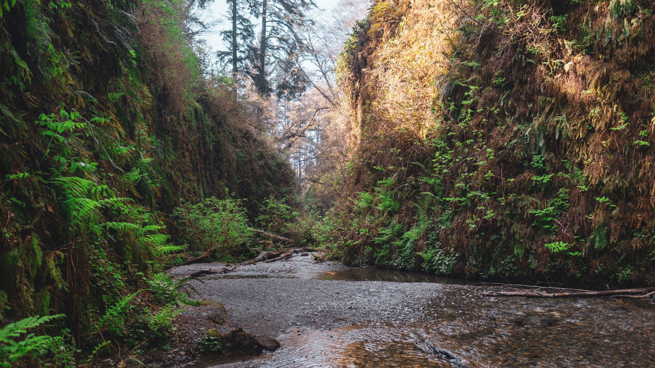

Fern Canyon Loop Trail, Prairie Creek
- Length: 1.8 km (1 mile)
- Duration: 45 – 60 minutes
- Difficulty: Easy
- Elevation gain: 36 m (120 ft)
The Fern Canyon loop trail is one of the shortest and most accessible hikes in California. Plus, it is one of my favorite hikes as the course takes you through a stunning, enchanting forest and emerges out to a beautiful waterfall.
The only bad thing about this hike is that it’s difficult to get to the trailhead because the road is bumpy and narrow. However, this challenge is soon forgotten when you see the beauty of the Fern Canyon. Plus, you can reward yourself by splashing in the refreshing stream. The trail is accessible all year round, but I recommend wearing waterproof boots if hiking between June to September as it can be pretty wet during these months.
Laurel Canyon Loop Trail, Orange County
- Length: 5.3 km (3.2 miles)
- Duration: 1.5 – 2 hours
- Difficulty: Easy
- Elevation gain: 184 m (275 ft)
The Laurel Canyon trail loop is another quick and easy hike with minimal elevation. However, despite being short, the route offers many stunning views, scenic sandstone formations, and coastal canyons.
The trail offers lots of shade, so it’s suitable to do in the hot summer months. But there is a seasonal waterfall, so if you want to see it the best time to go is the beginning of spring, when there is most likely to be water. You’ll find the trailhead at the parking lot at Willow Staging Area on Laguna Canyon road.
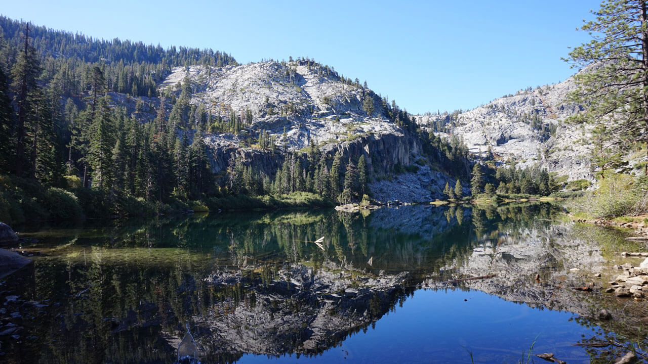

Eagle Lake Trail, Lake Tahoe
- Length: 3.1 km (2 miles)
- Duration: 45 mins – 1.5 hours
- Difficulty: Easy
- Elevation gain: 140 m (460 ft)
The Eagle Lake hike is one of the best trails in Lake Tahoe and is a gentle 3km (2 miles) trek that goes around picturesque falls, a lake, and through the lush forests. The route gives impressive views of Lake Tahoe and the Sierra high country. There are some steps to climb at the start of the trail, but it is not strenuous, and it is suitable for all abilities and levels. As part of this route goes through Desolation Wilderness, you will need to obtain a permit from the parking lot beforehand.
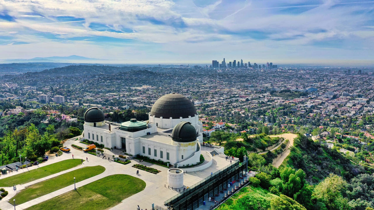

Griffith Observatory via West Observatory, Los Angeles
- Length: 4 km (2.1 miles)
- Duration: 45 mins – 1.5 hours
- Difficulty: Easy
- Elevation gain: 187 m (613 ft)
Griffith Observatory is one of the most famous hikes in California, and it can get crowded with tourists looking to get up close to the Hollywood sign. However, despite its popularity, Griffith Park is still a fantastic place to go hiking.
The West Observatory Trail is one of the best trails in Los Angeles and Griffith Park. It is short and easy, takes you through the woodsy glen of Ferndell, and gives a breathtaking perspective of the city. Better still, as it’s so close to town, you can go early in the morning when Griffith Park is most peaceful. Start at the Ferndell Trailhead at the bottom of Ferndell Drive.
Solstice Canyon Loop, Santa Monica
- Length: 4.8 km (3 miles)
- Duration: 45 mins – 1.5 hours
- Difficulty: Easy to moderate
- Elevation gain: 204 m (670 ft)
If you’re looking for one of the best hassle-free hikes in California, check out the Solstice Canyon Loop in Santa Monica. The entire walk is incredibly picturesque, and as the trail goes through the canyon, there is plenty of shade. On this trail, you’ll pass a flowing creek and small waterfall, then at the end, you’ll come to the ruins of Roberts Ranch House.
The Solstice Canyon Loop doesn’t feature an incredible summit landscape like some of the other hiking trails in California. However, it’s one of the most accessible as the path is wide and flat. It also makes for a lovely picnic spot as it has many picnic tables along the first part of the trail.
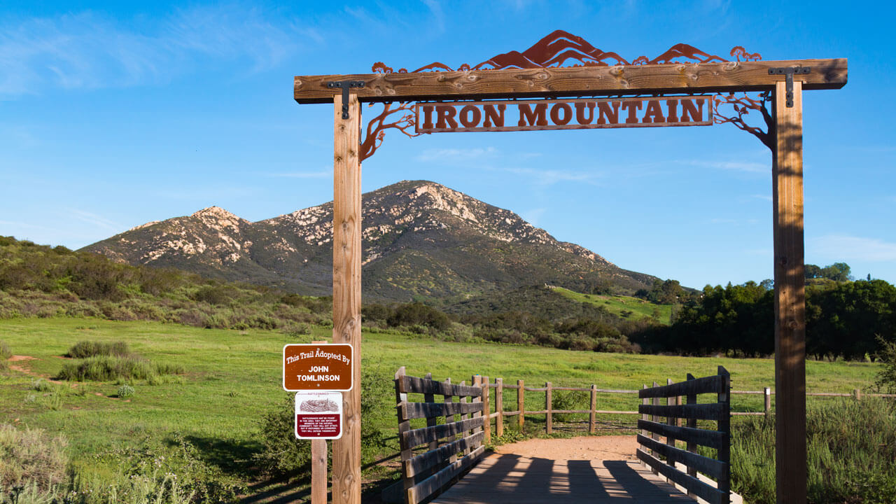

Iron Mountain Trail, San Diego
- Length: 8.4 km (5.2 miles)
- Duration: 2 – 3 hours
- Difficulty: Moderate
- Elevation gain: 336 m (1100 ft)
The famous Iron Mountain Trail is undoubtedly one of the best hikes in San Diego, offering stunning views from the summit, which is the highest mountain peak in Poway. In fact, the trail takes you so high above sea level that you can see as far as Mt. Woodson and the Catalina Islands on a clear day.
Because the summit is so high, you will experience quite a bit of elevation change. Even so, the trail is not too strenuous, and you don’t need to be an experienced trekker to make it to the top and enjoy the view. The trailhead is just off Highway 67 opposite Poway Road, a 30-minute drive from downtown San Diego.
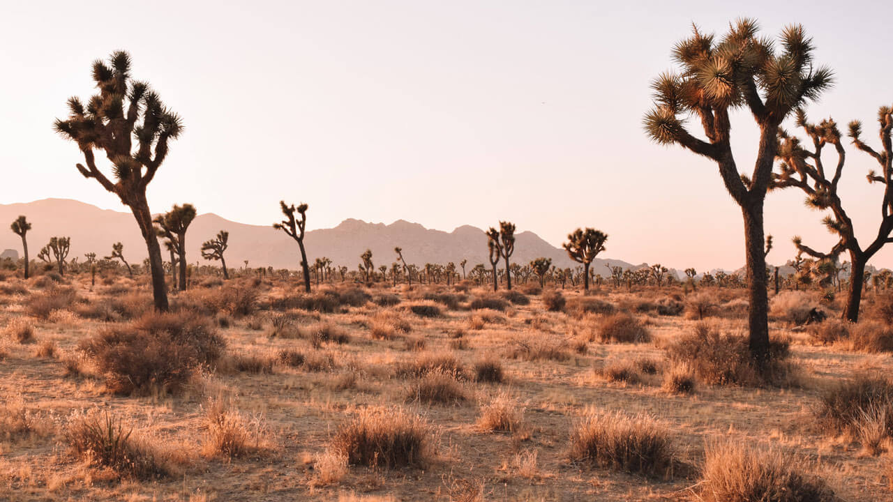
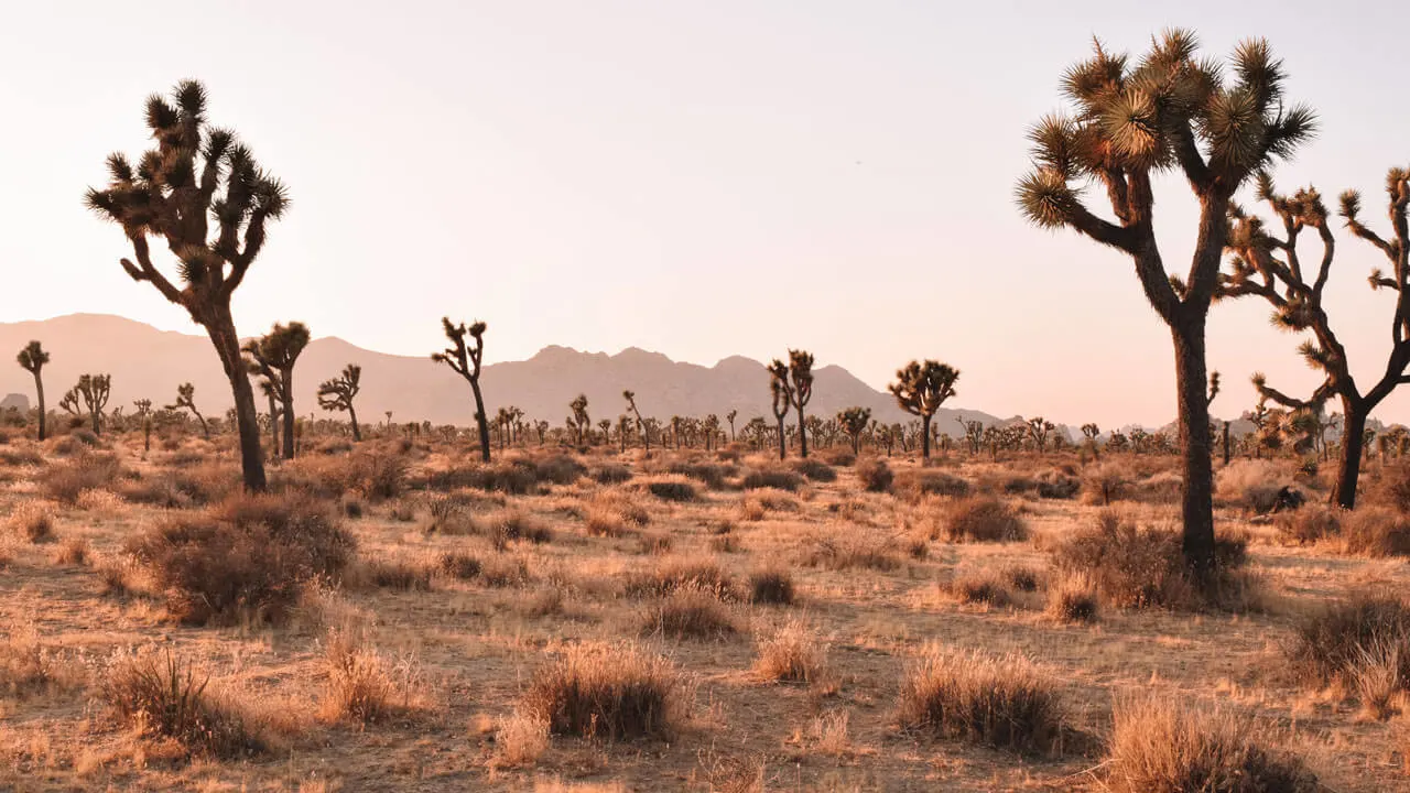
Black Rock Canyon to Panorama Loop Trail, Joshua Tree
- Length: 10.3 km (6.5 miles)
- Duration: 2.5 – 3 hours
- Difficulty: Moderate
- Elevation gain: 364 m (1194 ft)
Joshua Tree is a hikers paradise, but as it spans 800,000 acres, it can be overwhelming to know where to hike here! However, I find the Panorama Loop Trail that starts at Black Rock Canyon campground to be one of the best trails in Joshua Tree. It’s in the northwest corner of the park and close to the nearby towns.
This 10km loop will take you 2 to 3 hours and is not too strenuous, so it makes a pleasant morning or late afternoon trek. About halfway along the route, you’ll come to a spectacular 360-degree vista and will see yuccas juniper and even oak trees, as well as the iconic Joshua trees.

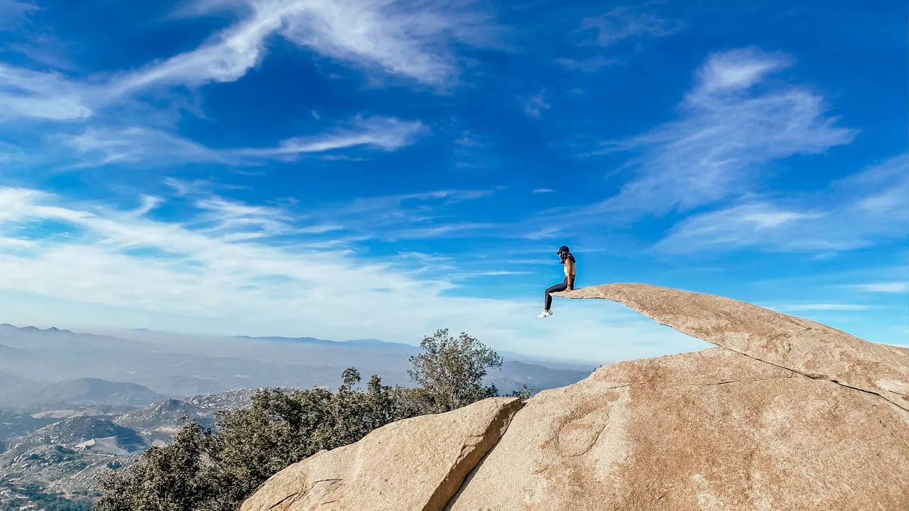
Potato Chip Rock via Mt. Woodson Trail, San Diego
- Length: 11.7 km (7.2 miles)
- Duration: 3 – 4 hours
- Difficulty: Moderate
- Elevation gain: 646 m (2120 ft)
Hiking to Potato Chip Rock summit at Mount Woodson is one of the best day hikes in California as it offers incredible views without too much of a challenge. As you can guess, the rock gets its name from its potato chip shape, which makes for a fun photo opportunity.
There is not much shade on this trail, and as a significant part is uphill, I recommend starting early in the morning before it gets too hot. The course is well maintained, though, so the climb up to the summit is safe.
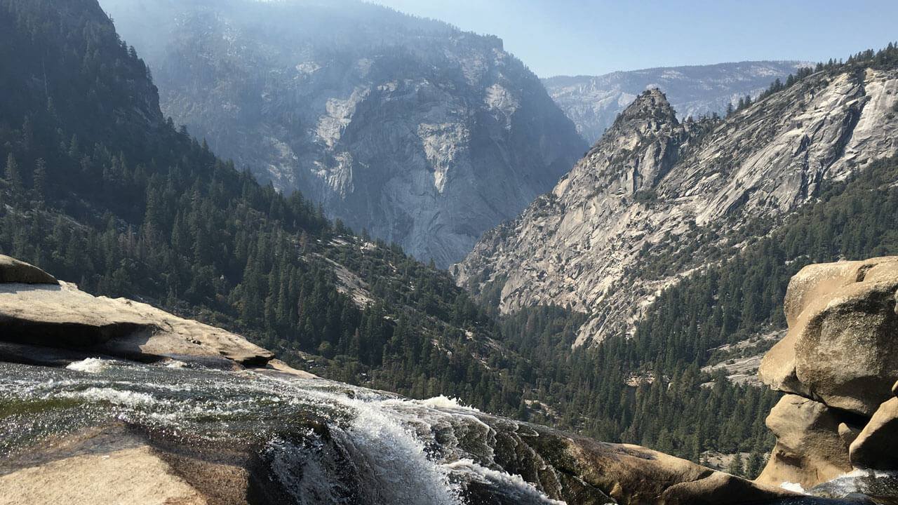

Vernal and Nevada Falls via the Mist Trail, Yosemite
- Length: 11.6 km (7.2 miles)
- Duration: 3 – 4 hours
- Difficulty: Moderate to hard
- Elevation gain: 676 m (2214 ft)
Hiking to the Vernal and Nevada Falls via the Mist Trail is one of the best trails in Yosemite National Park. It takes you to two stunning waterfalls and offers an abundance of beautiful scenery along the way. But be sure to hike it in spring if you want to see the waterfalls at their best. However, going in early summer makes for an exciting hike too as the falls spray out water creating the misty look you see in the photos.
There are many steps up to Nevada Falls, making it reasonably strenuous so prepare yourself or opt to try one of the shorter ones in this guide before tackling the Mist Trail.
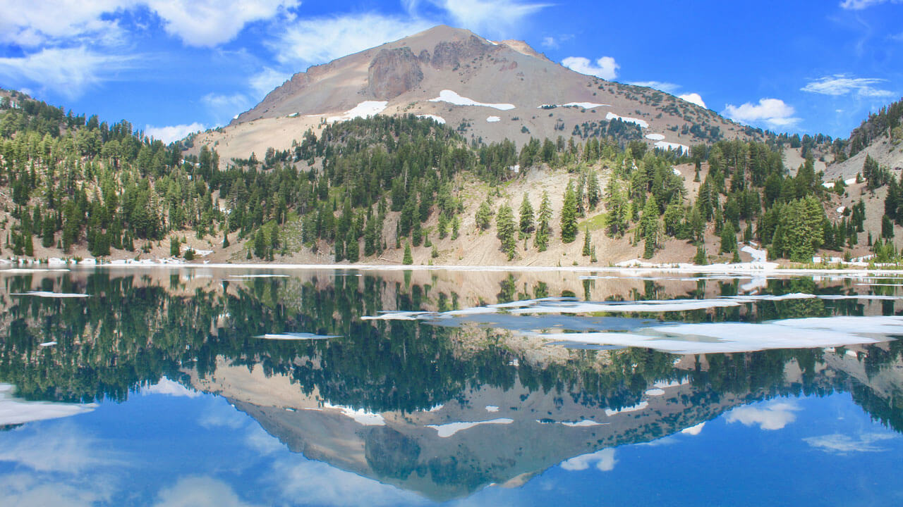

Lassen Peak, Lassen Volcanic National Park
- Length: 8 km (5 miles)
- Duration: 3 – 5 hours
- Difficulty: Moderate to hard
- Elevation gain: 600 m (1968 ft)
Lassen Peak makes for one of the best hikes in Northern California for anyone looking for a challenge. The trail takes you to the summit of one of the largest plug dome volcanoes worldwide, giving expansive views over the Lassen Volcanic National Park.
This hike can be challenging as there is minimal shade, so it can get scorching in the middle of the day and you also need to be careful of slippery rocks. However, if you start early, hydrate well, wear good hiking boots, and watch your step, this trail is totally doable and has beautiful views as a reward. Plus, you’ll enjoy a fantastic sense of achievement once you make it up to the top!