

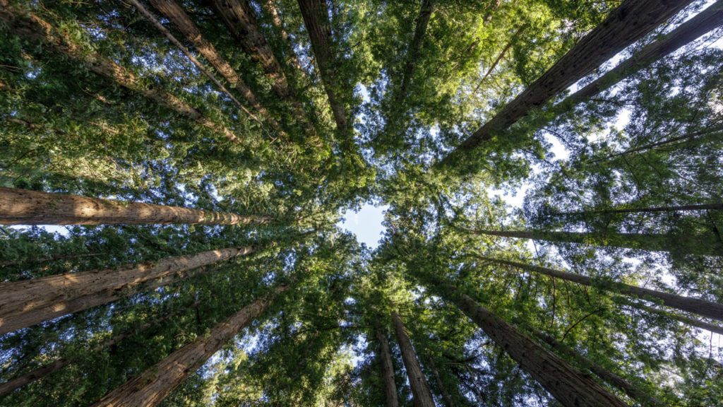
The sublime scenery and earthy feel of Redwood National Park make it one of the best places to go hiking when you need to detach from an overactive mind or fast-paced lifestyle. There is no better place to reground than in a vast forest, and Redwood National & State Parks offers plenty of opportunities.
No matter your hiking level or fitness ability, you’ll find plenty of suitable hikes in Redwood National Park. The trails feature some of the tallest trees globally, prehistoric plants, refreshing creeks, and majestic waterfalls. Make your next California nature hike one of these Redwoods hiking trails.
Best Hikes in Redwood National & State Parks
I’ve included hiking trails of all lengths and difficulties in this list, catering to all levels. What’s more, some are popular routes while others are hidden gems. And don’t forget to check out some of the other awesome things to do in Redwood National Park too!
But first: Don’t miss my other California hiking & park guides!
Lady Bird Johnson Grove Trail
- Length: 1.5 miles (2.4 km)
- Difficulty: Easy
- Elevation gain: 100 feet (31 m)
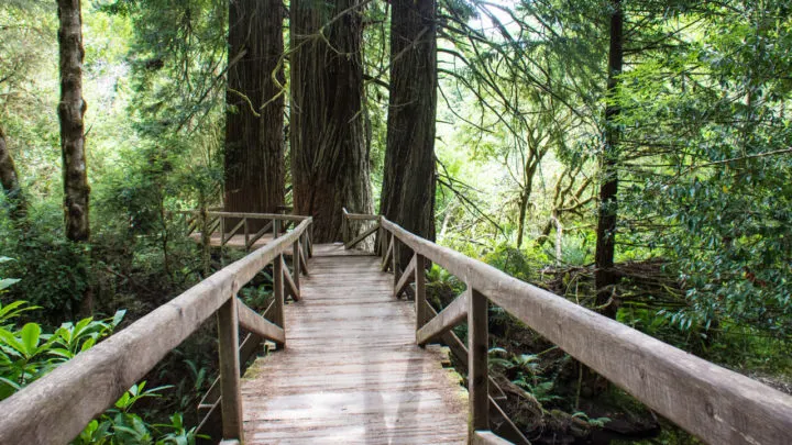
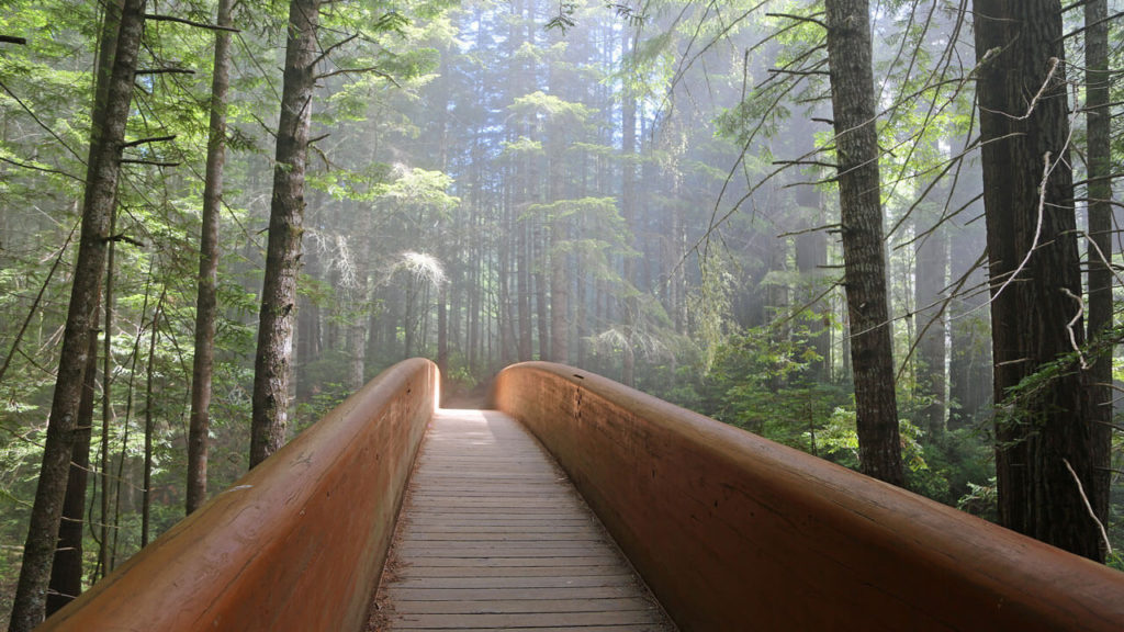
The Lady Bird Johnson Grove trail near Berry Glenn is one of the most popular trails in Redwood National Park. It takes you on a pleasant stroll through an upland stand of old-growth redwoods. The trail also features the memorial site for the former First Lady, an environmental activist.
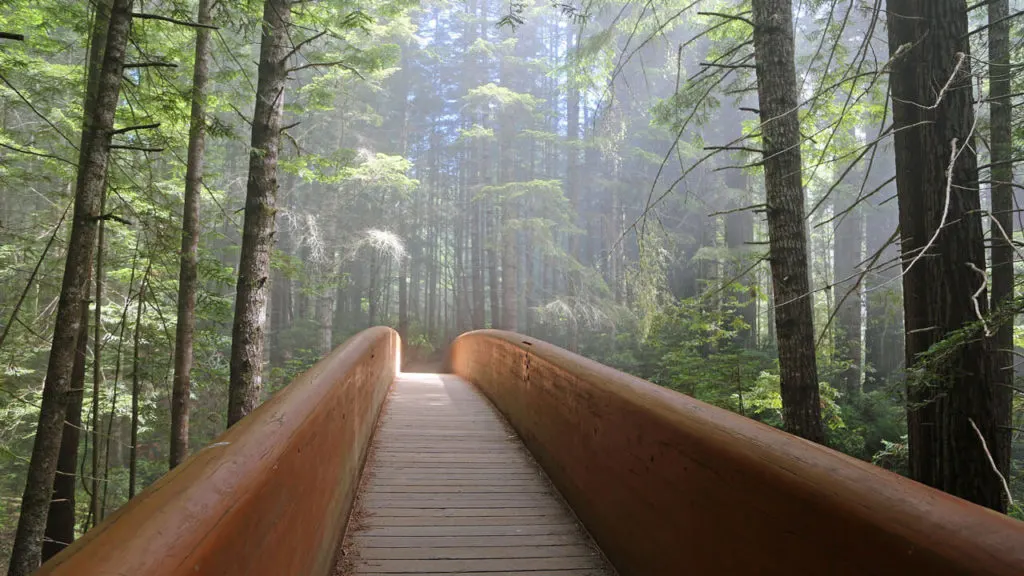
This trail is at its best during spring when the azaleas and rhododendrons bloom, creating an explosion of color. Most of the course is a dirt path with a picturesque wooden bridge with railings, which looks mesmerizing on a misty morning. You’ll find the trailhead a short distance up Bald Hills Road from Highway 101.
Stout Memorial Grove Trail
- Length: 0.7 miles (1.1 km)
- Difficulty: Easy
- Elevation gain: Minimal
Another popular short and easy hike is the Stout Memorial Grove Trail in Jedediah Smith Redwoods State Park. At less than three-quarters of a mile long, this is one of the shortest trails you will find in the area, and it makes an ideal stop-off for those entering the Redwoods from the north.
The trail passes by Smith River, where you can swim and kayak in during the summer months. It also makes an excellent spot for a picnic if you don’t have to rush off. You can access the trail from the east end of Howland Hill Road all year round and from Jedediah Smith Redwoods State Park Campground during the summer.
Tall Trees Grove Trail
Tall Trees Grove Trail
- Length: 4 miles (6.4 km)
- Difficulty: Moderate
- Elevation gain: 748 feet (228 m)
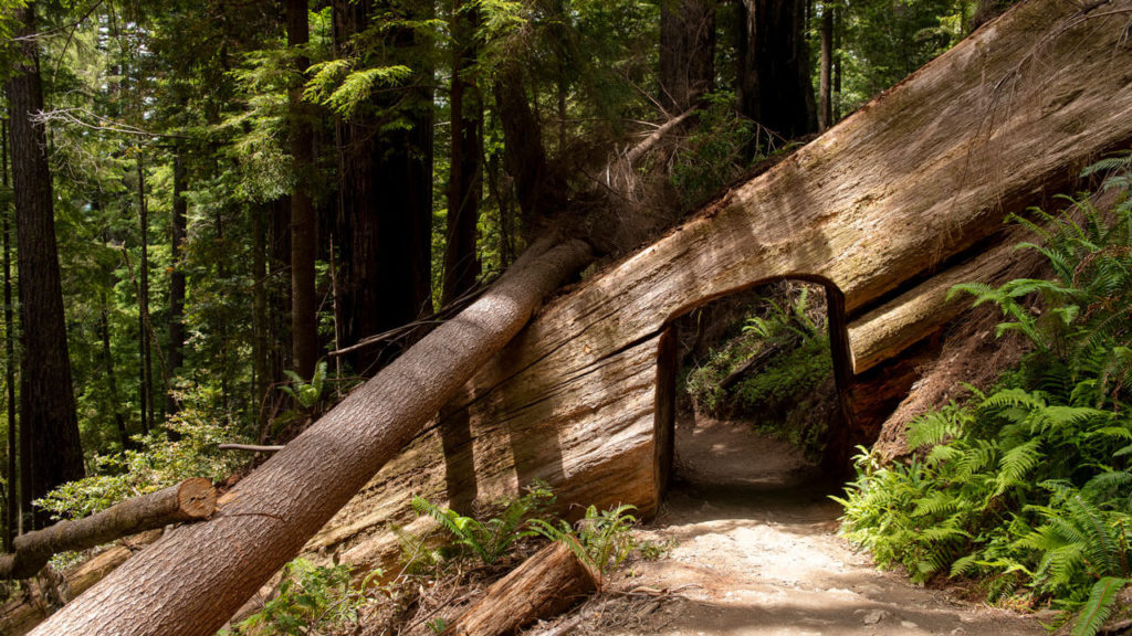
If you’re traveling to Redwood National Park to check out some of the tallest and broadest trees worldwide, Tall Trees Grove is your trail. The grove is home to around 350 Redwoods, including famous ones like the 379-foot tall Hyperion. You’ll see this huge tree and many more on the 4-mile loop in this remote part of the park.
To reach the trailhead, take the Tall Trees access road turnoff just before Redwood Creek Overlook on Bald Hills Road. Follow the road to the end, where you’ll find a gate, which is the trailhead.
You’ll need a permit and a passcode to do this hike, which you can get from the Thomas H. Kuchel Visitor Center on the coast. Although it’s a bit of extra effort to stop off at the visitor center on the way, it’s totally worth it.

Fern Canyon Loop Trail
- Length: 1.1 miles (1.8 km)
- Difficulty: Easy
- Elevation gain: 118 feet (36 m)
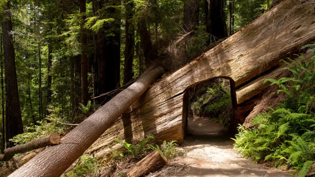
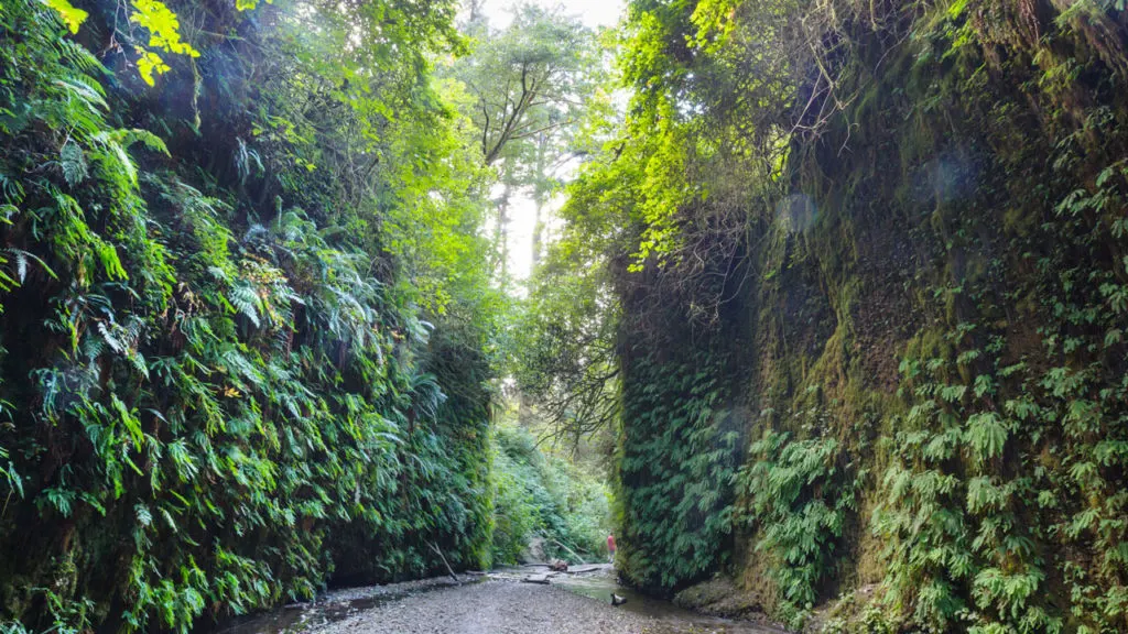
You cannot visit Redwood National Park without checking out the lush, prehistoric Fern canyon. This attraction is unique as various primal ferns dating back to around 325 million years ago have grown over a 50-foot-deep walled canyon. The area might seem familiar to you if you’ve seen The Lost World: Jurassic Park, as this was one of the filming locations!
Hiking to Fern Canyon is easy and accessible for most people. It’s a short 1.10-mile loop trail that starts from the end of Gold Bluffs Beach in Prairie Creek. The loop is gentle, flat, and only takes around 30 minutes. However, if it’s rained recently, ensure you’ve got some waterproof boots as the earth will be pretty wet.
Trillium Falls Trail
- Length: 2.6 miles (4.2 km)
- Difficulty: Moderate
- Elevation gain: 433 feet (132 m)
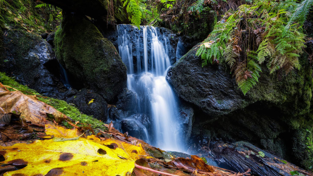
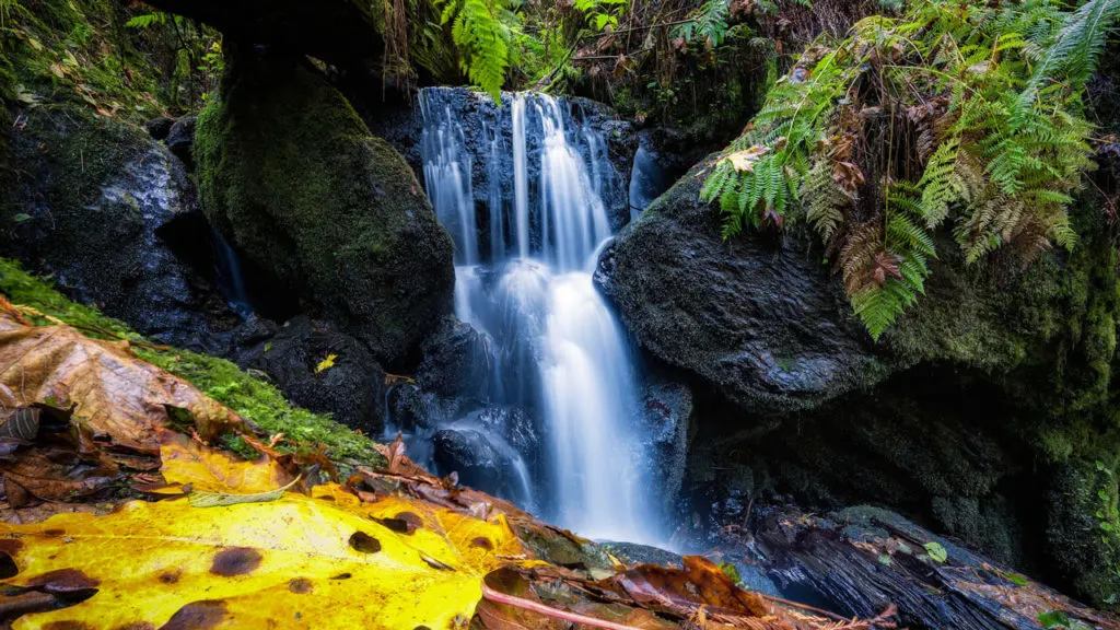
Trillium Falls in Berry Glenn is one of the most magical waterfalls, and I’m sure you will be in awe of it. The waterfall is tiny, but the moss-covered rocks, fern overgrowth, and lush greenery surrounding it make it look like something out of a fairytale.
There’s a moderately challenging climb with a 200 feet elevation gain to reach the falls. But as the trail is relatively short, it won’t take you much longer than 90 minutes to complete the loop. You’ll also pass by many old-growth redwoods, maples, and fir trees. You’ll find the trailhead by Elk Meadow picnic area, just off Davison Road, three miles north of Orick.

Cathedral Trees Loop Trail
- Length: 3 miles (4.8 km)
- Difficulty: Easy
- Elevation gain: 275 feet (84 m)
The Cathedral Trees trail is full of untouched nature, with some parts overgrown. This feature adds to its beauty, although it does make it a little tricky to navigate. You’ll see plenty of impressive giant Redwoods here, but the most popular is the 21-foot-diameter Big Tree. In fact, so many people come to see this tree that they have built a wooden viewing platform around it.
The entire loop trail is 3 miles long, but most people just do the short walk to Big Tree and then turn back. So if it looks busy at the trailhead, don’t panic, as the ambiance will be much more tranquil once you get past the beginning. The trailhead is at Prairie Creek Visitor Center and is well sign-posted.
Revelation Trail
- Length: 1 mile (61 km)
- Difficulty: Easy
- Elevation gain: Minimal
While at Prairie Creek Visitor Center, you might want to walk the short and sweet 1-mile Revelation Trail. The route is flat the whole way, so you’ll manage this one just fine even if you’re unfit. It also features a wheelchair-accessible design with 5-feet wide gravel paths and ropes along the sides.
The trail leads to Elk Prairie Creek Campground, with a short section of elevated walkways looping around giant redwood trees.
Elk Prairie Trail
- Length: 3.2 miles (5.1 km)
- Difficulty: Easy
- Elevation gain: 147 feet (45 m)
If you’re looking for peace and quiet, I recommend the Elk Prairie in Prairie Creek. This route is much less frequented than the others in the area, so head here to avoid the crowds. You’ll find the trailhead at Elk Prairie Campground, just down the road from Elk Prairie Campground.
The route is a nice mix of meadows and forest. However, this trail is unique because it runs through an area heavily populated by Roosevelt elk. To increase your chances of spotting these majestic mammals, come here in the late afternoon when the sun is lower in the sky, and the temperature starts to drop.

Damnation Creek Trail
- Length: 3.4 miles (5.47 km)
- Difficulty: Hard
- Elevation gain: 1190 feet (363 m)
The Damnation Creek Trail in Del Norte Coast Redwoods State Park is for you if you’re looking to push yourself to your limits rather than take a gentle stroll. As well as being one of the most challenging hikes, it stands out from most Redwood trails.
The route involves descending down a 1,100 feet westward-facing slope through the redwood forest until you arrive at a rugged, rocky coast. Here you can spot some extraordinary marine life along the shore and in the tide pools before embarking on the strenuous climb back up.
The trailhead is directly on Redwood Highway, but it’s unmarked, so I recommend navigating your way there with Google Maps.
The Coastal Trail, Skunk Cabbage Section
- Length: miles (11.75 km)
- Difficulty: Moderate
- Elevation gain: x feet (395 m)
Skunk Cabbage, near Berry Glenn, is part of the 1,200-mile California Coastal Trail system. It features diverse terrain, with only a tiny amount of redwood forest at the beginning. Instead, you’ll pass by Douglas fir and spruce trees, coastal bush, and sandy beaches. Therefore, it’s a nice change from many forested hikes here and a moderate challenge for avid hikers.
Interestingly, the trail was originally a logging road, but it’s hard to tell that today. The route features a descent of about 500 feet to a pristine beach, followed by a steep climb. You’ll find the trailhead just south of Elk Meadow. The turnaround point is at the beach, but you can continue to walk along the sand for another mile should you wish, and at this point, you’ll end up at Gold Bluffs Beach.