
Sequoia and Kings Canyon are two of California’s best national parks, standing side by side in the Southern Sierra Mountain Range. Together, they cover 1,353 square miles and feature various elevations ranging from 1,300 to 14,491 feet.
Sequoia National Park is famed for its giant sequoia groves (the world’s largest trees). In contrast, Kings Canyon is adored for its mountain peaks and deep canyons. As a result, one of the top Sequoia National Park activities is hiking, with over 1,000 miles of trails throughout the adjacent parks.
Hikes in Sequoia National Park and Kings Canyon are also highly diverse. They include gentle forest strolls, scenic lake trails, waterfalls hikes, and challenging mountain climbs. So, whether you’re a first-time hiker or seasoned trekker, you’ll want to add a few Kings Canyon hikes to your Sequoia National Park itinerary.
Best Hikes in Sequoia National Park
The following list of the best trails in Sequoia National Park range from less than a mile to 4 miles, so you can squeeze in a few, even if you’re on a day trip or even a California road trip!
But first: Know where to stay in Sequoia & Kings Canyon and other need-to-know details in the Kings Canyon & Sequoia National Parks Travel Guide.
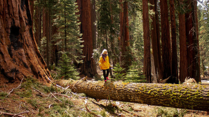
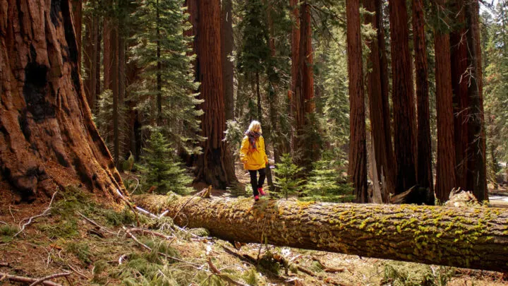
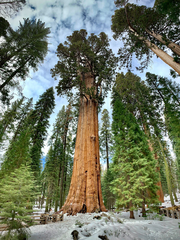
General Sherman Tree Trail
- Difficulty: Easy
- Distance: 1.5 miles/ 2.6 km
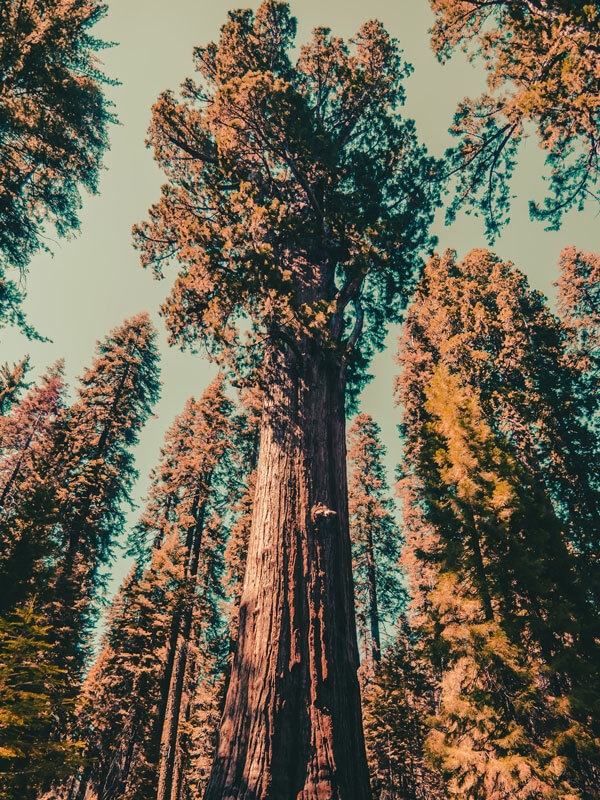
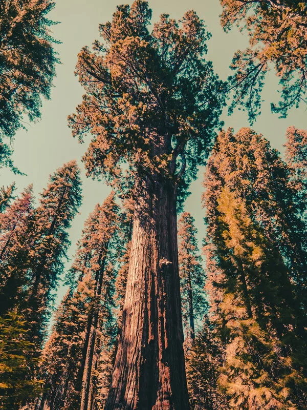
General Sherman Tree is likely the most frequented Sequoia National Park trail. Aside from being short and easily accessible, the route takes you to the most famous giant tree in the world, General Sherman. The famous tree is 275 feet tall (but still growing) and around 2,200 years old.
The loop trail, located near Three Rivers, is paved and begins with a short descent down a hill to reach the tree and then a gentle incline back up. Along the way, you’ll spot many interesting information panels explaining the ecology of sequoia trees. If you want to extend your walk, you can follow The Congress Trail afterward. This is another short paved route through the groves and is located next to General Sherman.
Big Trees Trail
- Difficulty: Easy
- Distance: 1.3 miles/ 2.1 km
Another one of the most popular hikes in Sequoia National Park is the Big Trees Trail near Stony Creek Village. This short, 1.3-mile paved loop is a relaxed and accessible way to see the park’s giant trees, and you don’t even need hiking boots. However, even if you’re an experienced hiker looking for challenging treks, The Big Tree Trails can serve as a nice warm-up to a mountain climb.

Moro Rock Trail
- Difficulty: Moderate
- Distance: 3.8 miles/ 6.1 km
A longer and slightly more challenging route in Sequoia is the Moro Rock Trail near Stony Creek Village. The trail involves climbing over 400 stairs to reach the rock, but it is well worth the effort as you’ll be greeted with a spectacular view when you arrive at the top.
The complete 3.8-mile trail starts at Giant Forest Museum and involves a peaceful walk amongst the trees before the incline. You can also choose to do just the last part, making it a short 0.6 mile/1 km route. However, note that the short version still involves the stairs.
Crescent Meadow Loop Trail
- Difficulty: Easy
- Distance: 1.7 miles/ 2.7 km
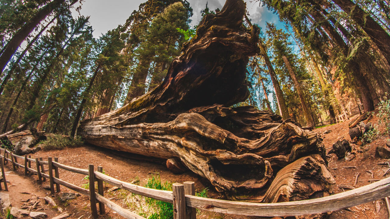
The Crescent Meadow Loop Trail is a gentle yet scenic loop near Three Rivers with gorgeous flowers and wildlife like deers and even black bears. Along the route, you’ll also pass Tharp’s Log, an 18th-century log cabin built by a single sequoia tree. It won’t take longer than an hour to complete this loop, but you can extend your walk by joining one of the adjacent routes like the Trail of the Sequoias.

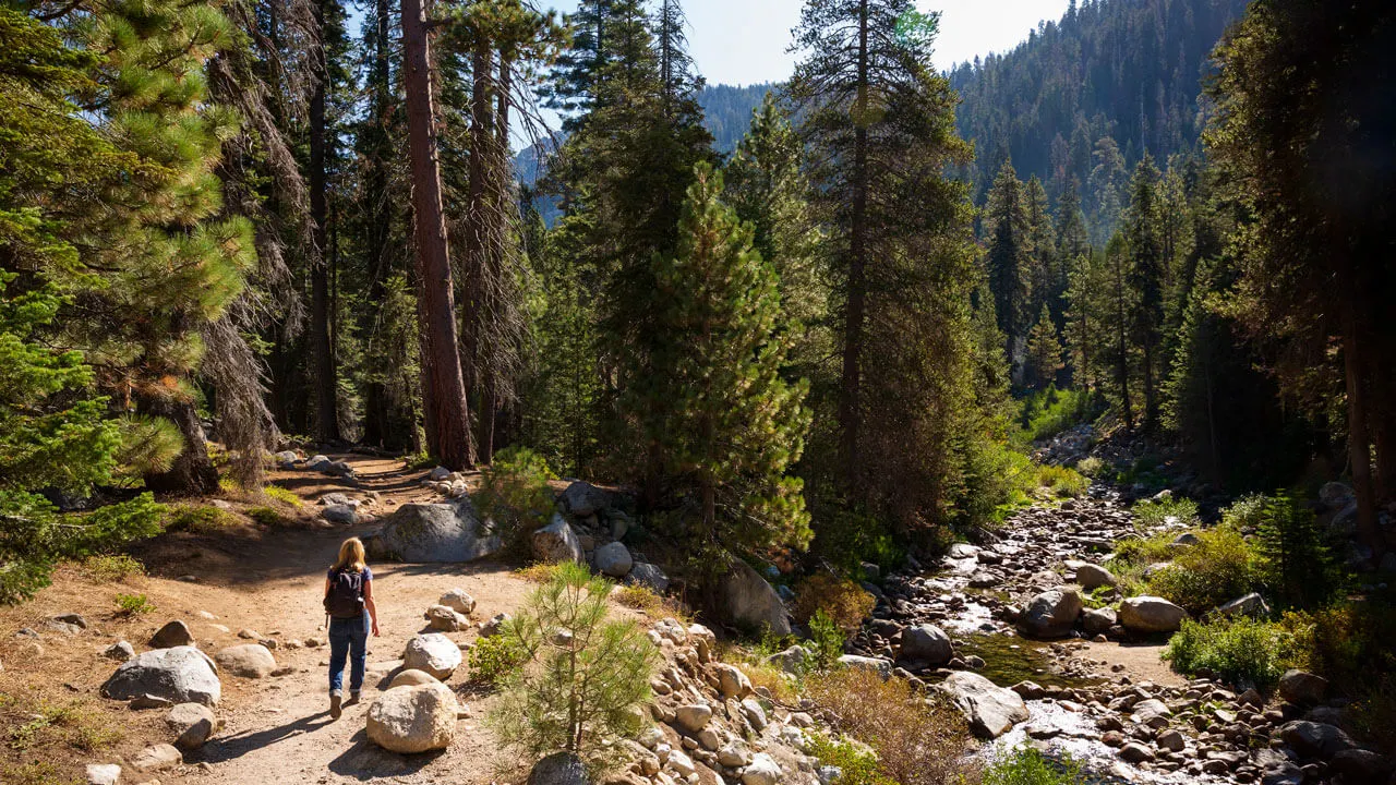
Tokopah Falls Trail
- Difficulty: Moderate
- Distance: 4 miles/ 6.4 km
Sequoia National Park is not known for waterfall hikes, but the Tokopah Falls Trail is one of the few you will find here. What makes it one of the top Sequoia hikes is that it follows the gorgeous Kaweah River along the granite cliffs before opening out to the vast waterfall. It’s an excellent alternative to all the forest walks!
It’s best to hike this trail in late spring or early summer as this is when water in the falls is most abundant. During this time, you’ll get to admire the water cascading 1,200 feet, and you’ll likely spot some wildlife around, too.
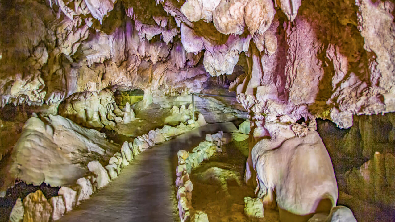

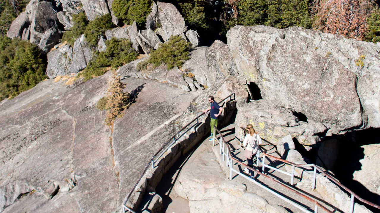
Crystal Cave Trail
- Difficulty: Moderate
- Distance: 0.8 miles/ 1.3 km
Crystal Cave is one of the most unique hikes in Sequoia National Park and one of the quickest to complete, too. Unfortunately, not many visitors are aware that this deeply carved marble cavern exists, but if you’re lucky enough to know, it will be one of the highlights of your trip.
This is one of the only Sequoia hikes that require you to go with a tour guide. Your guide will take you through the steep and winding cave trail, heading into darkness. It’s very short and only takes about 30 minutes, but don’t be fooled as it is a little strenuous at times.
Little Baldy
- Difficulty: Moderate
- Distance: 3.3 miles/ 5.3 km
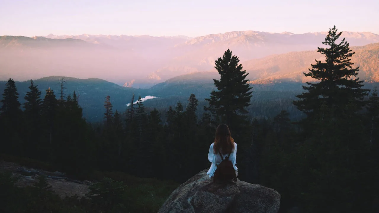
Although not as famous as Big Baldy in Kings Canyon, Little Baldy, situated between the two national parks, offers spectacular views nonetheless. The trail has an overall elevation of 790 feet (242m), and there are some steep parts, but luckily they are short.
When you reach the top of the granite dome, you’ll enjoy stunning views overlooking the western side of Sequoia National Park and the Great Western Divide. The entire route takes between 2 and 3 hours to complete, and the peak offers some lovely picnic spots, too.
Best Hikes in Kings Canyon National Park
These Kings Canyon hikes feature giant trees, refreshing creeks, wildlife encounters, and incredible views of the surroundings.

General Grant Trail
- Difficulty: Easy
- Distance: 0.7 miles/ 1.1 km
The quite short General Grant Trail is perhaps the most popular walking route in Kings Canyon, leading to the massive General Grant Tree. Although it’s not as big as General Sherman, it’s still one of the world’s most giant trees and is just as spectacular. As the trail to reach it is so short, there’s no reason not to stop by and check it out.
North Grove Loop
- Difficulty: Easy
- Distance: 1.8 miles/ 2.9 km
If you walk the General Grant Trail and feel like extending your hike, we recommend switching onto the North Grove Loop afterward. This trail is less crowded and slightly longer than the General Grant Trail but is still short and easy. It’s also more scenic because, in addition to walking among giant sequoias, you’ll pass through peaceful meadows and creeks. If you’re still not tired afterward, you can then join the Dead Giant Loop Trail for an additional 3.25-mile (5.2km) hike.
Mist Falls Trail
- Difficulty: Moderate
- Distance: 8.7 miles/ 14 km
This reasonably challenging route will take four to five hours to complete, so we recommend starting early to finish it before the hottest part of the day. Although it is long, it’s undoubtedly one of the best hikes in Kings Canyon as it’s incredibly scenic the whole way. Along with the best Kings Canyon waterfall and incredible views out to Paradise Valley, there’s a high chance you’ll have some bear encounters here so have your bear spray ready just in case!
Big Baldy Ridge Trail
- Difficulty: Moderate
- Distance: 6.4 miles/ 10.3 km
The 6.4-mile Big Baldy Ridge Trail in Grant Grove involves a challenging uphill climb followed by a gratifying 360-degree view of both national parks. You’ll need to plan around 3 hours to complete this route, and as there is a 1420 feet (434m) elevation gain, it may prove a challenge for some. With such expansive vistas, you’ll spot Castle Peak, Alta Peak, Sawtooth Peak, and the Great Western Divide, making it one of the best hikes in Kings Canyon.

Panoramic Point
- Difficulty: Easy
- Distance: 0.5 miles/ 0.8 km
If you want to see a spectacular view over the national park but don’t fancy the effort of climbing a peak, head to Panoramic Point in Grant Grove Village. The trail is half a mile, but you’ll experience incredible 360-degree views of Kings Canyon and the Sierra range in the distance. Plus, the drive up to the starting point is exceptionally scenic, too. The roads that lead up to the trailhead are narrow and winding at times, but the walking trail is safely paved.